Lulworth Crumple: The Limestone Cracked, the Mudstone Flowed
The Reading Room Published
Short answer
The Lulworth Crumple is a set of small folds in the cliff at Stair Hole, beside Lulworth Cove in Dorset. Its hard limestone layers cracked but stayed nearly continuous, while soft mudstone sheared and flowed.
Viewing card
- Where
- Stair Hole, beside Lulworth Cove on the Dorset coast, England
- Seen from
- Ground level, from the cliff top around Stair Hole, in two photographs of its west and east ends
- Captured
- Photographs by Adrian Pingstone, from the Wikimedia Commons file pages; source pages read 2026-11-16
- Reading altitude
- From the cliff-top path above Stair Hole, looking across the hole at the opposite wall, where single limestone beds can be traced through the folds
- Written by
- A squeeze that bent the layers into the Purbeck monocline; inside it, the hard limestone beds cracked while the soft mudstone beds sheared and flowed
This card as data (CSV) About this file
Data: BGS Earthwise (facts only) and the Geological Society of London (cited by source id), retrieved 2026-11-16; GOV.UK report under the Open Government Licence v3.0
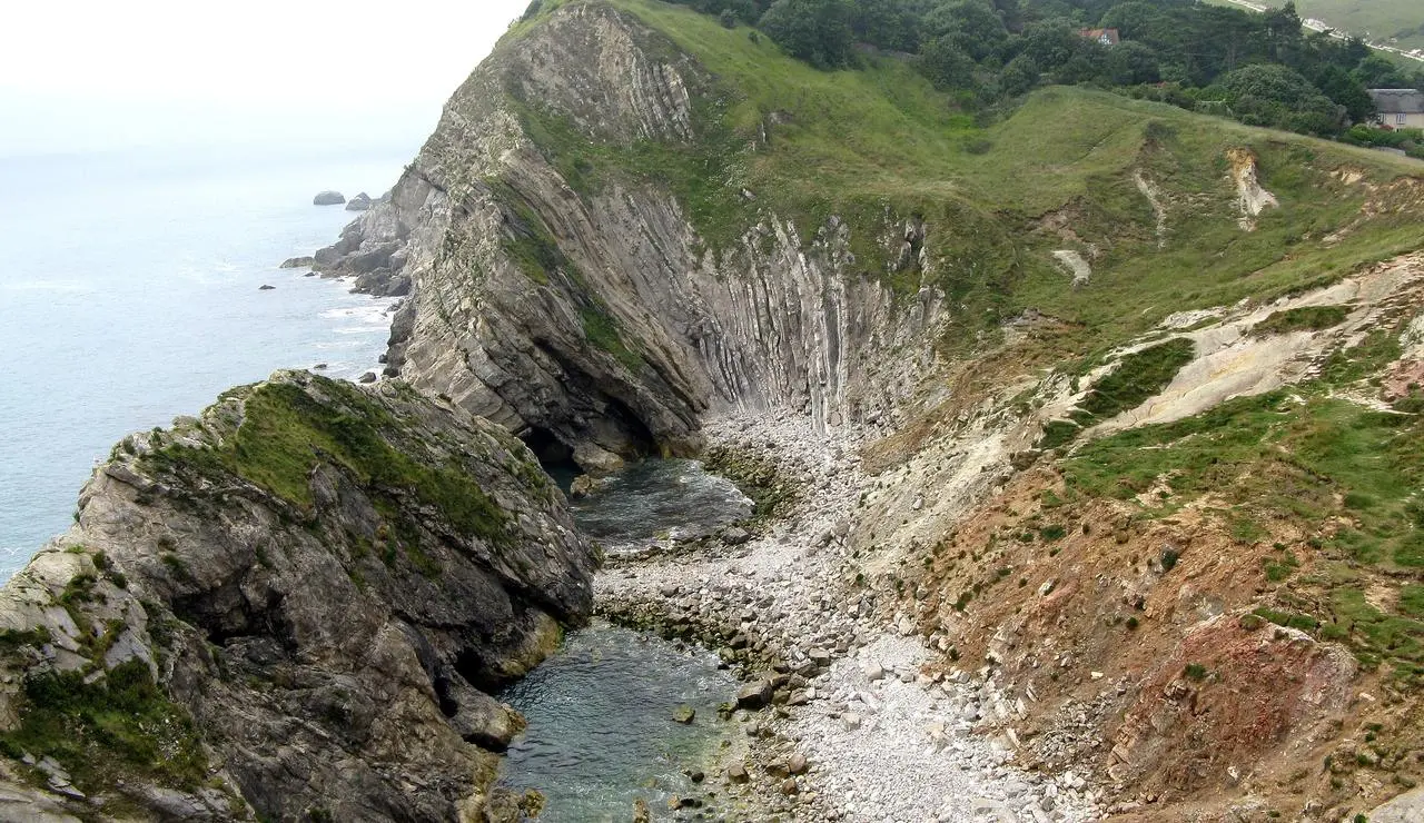
Stair Hole from its west end: a narrow inlet, a shingle floor, and a far cliff wall where the rock layers stand steeply on end.
"West end of Stair Hole, Lulworth, Dorset, England" by Adrian Pingstone — https://commons.wikimedia.org/wiki/File:West_end_of_Stair_Hole,_Dorset,_England_arp.jpg — Public domain (US and EU: released into the public domain worldwide by the photographer, Adrian Pingstone, as stated on the Commons file page); modified: cropped, resized
In the cliff beside a small Dorset cove, rock layers bend into small folds visible from the cliff top. The Geological Society’s page on Lulworth explains why the folds look so uneven. The Purbeck Beds alternate hard limestone and soft mudstone. The two kinds of rock answered the same squeeze in different ways.
What is the Lulworth Crumple?
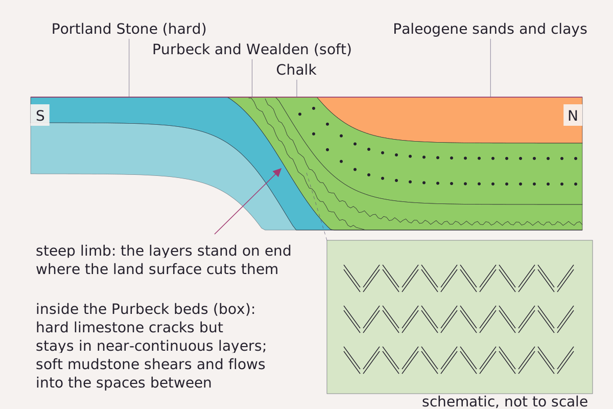
A step-shaped fold in cross section, south at left. The layers drop steeply to the north, and the land surface cuts across them so each one crops out as a band. The box shows the Purbeck beds inside the steep part.
Benchmark Schematic, not to scale; fold shape from GOV.UK and the Geological Society, outcrop order from the Geological Society, as cited in the text.
"The Purbeck monocline and the crumpled Purbeck beds, schematic" by Meridian & Moraine, https://meridianandmoraine.com/strata/lulworth-crumple/, licensed under CC BY 4.0 (https://creativecommons.org/licenses/by/4.0/).
Data: Monocline definition from Radioactive Waste Management, Hampshire Basin Regional Geology (GOV.UK, 2018), Open Government Licence v3.0; Outcrop order and rock behavior paraphrased from the Geological Society of London, retrieved 2026-11-16
The crumple is a small part of a much larger fold. The GOV.UK regional geology report for the Hampshire Basin defines a monocline as a “Step-shaped fold in layered rock strata.” On the Dorset coast, the Geological Society describes the Chalk rearing up to stand on end in a ridge that runs from Ballard Down, past Corfe Castle, to Lulworth Cove. That ridge is the Purbeck Monocline.
The Society’s page on Lulworth and the Wessex Basin adds that the much-photographed small folds in Stair Hole are related to the same folding. For the wider frame, the BGS Earthwise account of the region describes the Hampshire Basin as a broad down-fold, gently tilted on its northern, eastern and western sides. On the south it is bounded by a narrow zone of steeply inclined layers, seen from the Isle of Wight west through Purbeck and Lulworth Cove to Durdle Door.
The GOV.UK report notes near-vertical beds in the Purbeck monocline. Where the land surface cuts across a fold like this, the layers crop out side by side as bands. Inland from the coast at Lulworth, the Geological Society lists hard Portland Stone first, then the softer Purbeck, Wealden and Greensand beds, then the vertical Chalk ridge. North of the ridge lie soft sands and clays of Tertiary age.
How do flat layers end up folded?
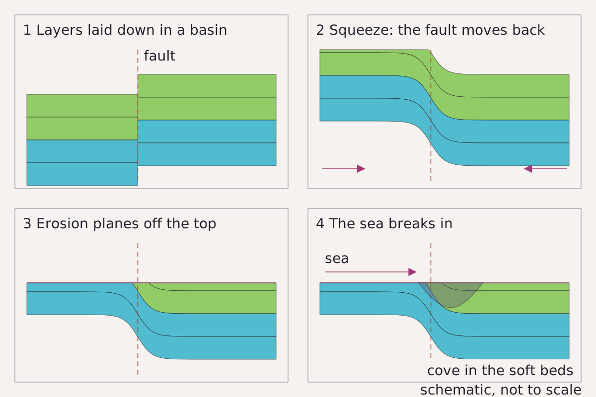
Four steps from flat layers to a cove: layers laid down in a basin beside a fault, the fault pushed back the other way, the top planed off by erosion, and the sea breaking into the soft beds behind the hard ones. Fault position and shape are schematic.
Benchmark Schematic, not to scale; sequence from the Geological Society, GOV.UK and BGS Earthwise accounts cited in the text.
"From flat layers to a crumpled cliff, in four steps, schematic" by Meridian & Moraine, https://meridianandmoraine.com/strata/lulworth-crumple/, licensed under CC BY 4.0 (https://creativecommons.org/licenses/by/4.0/).
Data: Sequence paraphrased from the Geological Society of London and BGS Earthwise (facts only), retrieved 2026-11-16, and from Radioactive Waste Management, Hampshire Basin Regional Geology (GOV.UK, 2018), Open Government Licence v3.0
The layers began flat. Earthwise describes the Wessex Basin as a large basin under southern England that sank and filled with sediment over a very long time. It keeps that apart from the Hampshire Basin, a down-fold of the same layers that came much later and shows at the surface.
The Geological Society calls the later step tectonic inversion. Part of the Wessex Basin, holding several kilometers of Jurassic layers, was pushed back up, and the Purbeck Fault at its edge was reactivated as a thrust. The GOV.UK report tells a similar story for the whole region. Its main faults were active while the Jurassic and Cretaceous sediments piled up, and the strongest folding came later, when movement on them reversed.
The Society’s page also sets out the cause of the squeeze. Northwestern Europe sits between the spreading Mid-Atlantic Ridge and Africa converging with Europe from the south. That compression has squeezed the sedimentary basins around Britain and Ireland.
Inside the fold, the two kinds of rock behaved differently. Read the Purbeck Beds as a stack of manuscript pages pushed from one side, where the stiff pages crease and split and the soft ones smear into the creases. In physical terms, according to the Geological Society, the limestone beds broke but held together as nearly unbroken layers, while the mudstone beds sheared and flowed into the gaps between them.
Erosion then planed off the top, and the sea did the rest. The Geological Society notes that on the east side of Stair Hole the massive Portland Stone still shields the soft beds from the sea. A small breach on the west side let the sea into the soft Purbeck Beds and Wealden behind it. An Earthwise photo caption describes the same place as Portland Stone and Purbeck Limestone breached by a sea that is making a cove.
How old is the Lulworth Crumple?
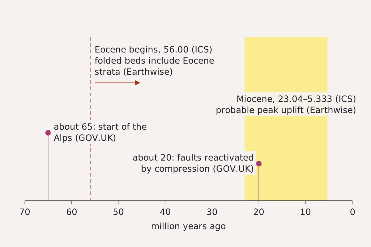
The age statements on this page on one time line: the start of the Eocene, the Miocene, and two dates from the GOV.UK report.
Benchmark Each age on the time line taken from this page’s CSV; sources and ages in the table.
"Age statements for the Purbeck folding on one time line" by Meridian & Moraine, https://meridianandmoraine.com/strata/lulworth-crumple/, licensed under CC BY 4.0 (https://creativecommons.org/licenses/by/4.0/).
Data: Radioactive Waste Management, Hampshire Basin Regional Geology (GOV.UK, 2018), Open Government Licence v3.0; BGS Earthwise, Bedrock Geology UK South: Cenozoic (facts only), retrieved 2026-11-16; International Commission on Stratigraphy, International Chronostratigraphic Chart v2024/12, single boundary ages only
None of the sources read for this page gives a measured date for the folds at Stair Hole itself. They offer regional statements instead, each framed its own way.
The GOV.UK report links the most significant folding in the region to a reversal of fault movement “during the formation of the Alps (which began approx. 65 million years ago).” In the same section, it says the faults were “reactivated by compressive forces approximately 20 million years ago.” The 65 million figure in the GOV.UK report is its start date for the Alps, not a date for the folds.
Earthwise notes that the Alpine Orogeny, the mountain building that raised the Alps and Pyrenees, has been attributed to the collision of the European and African plates in Paleogene to Neogene times. In southern England, its chief effect was inversion of the Wessex–Channel Basin, with uplift on the Purbeck–Wight structures. Earthwise estimates that the base of the Eocene is displaced by about 1,500 m across those structures, so the folding is younger than the start of the Eocene, which the ICS chart (version 2024/12) puts at 56.00 million years ago.
A gap in sedimentation during the Miocene, Earthwise adds, probably marks the time of greatest uplift in southern Britain. The ICS chart runs the Miocene from 23.04 to 5.333 million years ago, so the GOV.UK figure of about 20 million years falls inside the epoch that Earthwise names.
| Claim | Age | Source |
|---|---|---|
| Main faults of the region reactivated by compression | About 20 million years ago | GOV.UK report, 2018 |
| Mountain building that the report ties to the main folding begins | About 65 million years ago | GOV.UK report, 2018 |
| Basin pushed up, uplift on the Purbeck–Wight structures | Paleogene to Neogene, given for the plate collision behind the uplift | Earthwise |
| Base of the Eocene displaced by about 1,500 m | Folding younger than the start of the Eocene (inferred on this page) | Earthwise |
| Start of the Eocene | 56.00 million years ago | ICS chart 2024/12 |
| Gap in sedimentation, probable time of greatest uplift | Miocene | Earthwise |
| Miocene Epoch, according to the ICS chart | 23.04 to 5.333 million years ago | ICS chart 2024/12 |
Download the age statements (CSV) (about this file) Data: Radioactive Waste Management, Hampshire Basin Regional Geology (GOV.UK, 2018), Open Government Licence v3.0; BGS Earthwise (facts only), retrieved 2026-11-16; ICS International Chronostratigraphic Chart v2024/12, single boundary ages only
The Geological Society questions the label itself. Its page notes that many accounts call the Purbeck Monocline Alpine, as if it were an outer ripple of the Alps, and argues that this misleads because the rest of France shows little folding. It describes the structure instead as inversion driven by the squeeze on northwestern Europe. Read together, the dated statements fit a squeeze after the Eocene began, and the sources differ on how to name it and how closely to date it.
Reading the folds from the cliff top
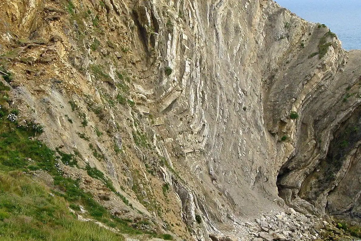
The folded wall at the east end of Stair Hole: pale beds bend into tight V shapes, and broken rock lies at the foot of the wall.
"East end of Stair Hole, Dorset, England" by Adrian Pingstone — https://commons.wikimedia.org/wiki/File:E_end_of_Stair_Hole,_Lulworth,_England_arp.jpg — Public domain (US and EU: released into the public domain worldwide by the photographer, Adrian Pingstone, as stated on the Commons file page); modified: cropped, resized
Stair Hole is read here from above only. Both photographs on this page look into the hole from above, and this page gives no route into the hole or onto the shingle. For this outcrop, the reading altitude is the cliff-top path, looking across at the opposite wall from a safe distance back from the edge.
From there, the wall can be read in a few steps.
- Find the pale beds that stand out as ridges in the photograph and pick one.
- Follow it along the wall and note where it bends into a V and where it breaks into straight pieces.
- Look at the duller, crumbly bands between the ridges, which fill the space between the stiff beds.
- Step back to the whole wall and notice that the folds sit inside layers that, taken together, stand steeply.
That last step ties the crumple back to the monocline. To see how steep layers like these are drawn as bands of color on paper, turn to how to read a geologic map. For another coastal outcrop read from a public path, see columnar basalt at the Giant’s Causeway. The Benchmarks page explains how schematic figures and age tables are handled across the site.
Next time a cliff or road cut shows bent layers, find a safe pull-off or viewpoint at a distance, then pick one stiff bed and follow it through a bend. If it snaps into straight pieces while the softer beds around it fill the gaps, the rock is recording two responses to one squeeze.
Next overpass
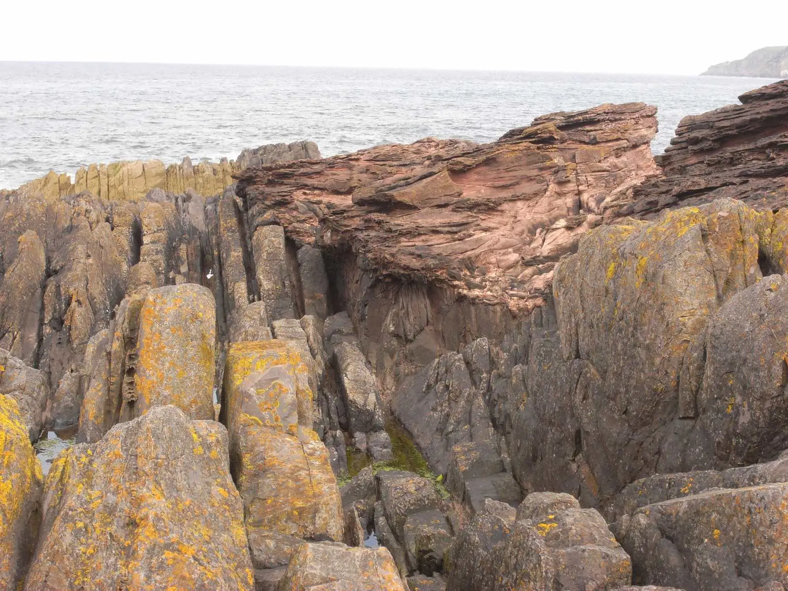
- Siccar Point: another cliff of rock layers, where tilted beds were worn flat and then buried under new ones.
- How to read a topographic map: steep ground read from above, as contour lines and their interval on a map.
Sources
- The Geological Society of London, “Lulworth,” 100 Great Geosites (coastal), with text reproduced from the British Geological Survey and by Howard Colley. www.geolsoc.org.uk/science-and-policy/100-great-geos…Read: full page, paraphrased
- The Geological Society of London, “Lulworth and the Wessex Basin,” Plate Tectonic Stories. www.geolsoc.org.uk/science-and-policy/plate-tectonic…Read: full page, paraphrased
- Radioactive Waste Management, Hampshire Basin and Adjoining Areas Regional Geology, National Geological Screening for a GDF, version 1.0a (GOV.UK, published 19 December 2018), compiled from British Geological Survey information. www.gov.uk/government/publications/hampshire…Read: pages 3 and 14–15 (rock structure section and glossary), from the PDF text
- British Geological Survey, “Hampshire Basin and adjacent areas - Geology,” BGS Earthwise, page revision of 18 April 2016. earthwise.bgs.ac.uk/index.phpRead: full page; facts only
- British Geological Survey, “Bedrock Geology UK South: Cenozoic,” BGS Earthwise. earthwise.bgs.ac.uk/index.php/Bedrock_Geology_UK_Sout…Read: full page; facts only
- International Commission on Stratigraphy, International Chronostratigraphic Chart, version 2024/12. stratigraphy.org/ICSchart/ChronostratChart2024-12.…Read: full chart (Silurian, Devonian, Paleogene and Neogene boundary ages used); change log checked for later versions
Cite this page
The Reading Room. “Lulworth Crumple: The Limestone Cracked, the Mudstone Flowed.” Meridian & Moraine, published 16 November 2026. https://meridianandmoraine.com/strata/lulworth-crumple/. Accessed on the date you read it.
How readings are checkedAll correctionsReport an error on this page (contact@meridianandmoraine.com)
More from Reading Rock Layers
Reading Rock Layers
Siccar Point: Hutton’s Lower Beds Stand Almost on End
Image credit
"Hutton’s Unconformity at Siccar Point, Scotland" by Lysippos — https://commons.wikimedia.org/wiki/File:Hutton%27s_unconformity_siccar_point.JPG — CC BY 3.0 (https://creativecommons.org/licenses/by/3.0/); modified: resized
Reading Rock Layers
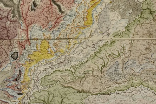
How to Read a Geologic Map: A Contact Bends With the Land
Image credit
"A Delineation of the Strata of England and Wales, with part of Scotland (detail)" by William Smith (1769–1839); British Library — https://commons.wikimedia.org/wiki/File:Geological_map_-_William_Smith,_1815_-_BL.jpg — CC0 1.0 (https://creativecommons.org/publicdomain/zero/1.0/); modified: cropped
Reading Rock Layers
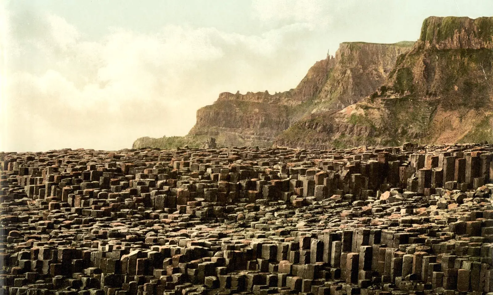
Columnar Basalt: Not Every Causeway Column Is a Hexagon
Image credit
"Giant's Causeway, County Antrim, Ireland, photochrom published by the Detroit Publishing Co. under license from Photoglob Zürich" by Unknown author — https://commons.wikimedia.org/wiki/File:Giant%27s_Causeway,_County_Antrim,_Ireland,_1890s.jpg — Public domain (US: published before 1931 (photochrom printed between 1890 and 1900); EU: anonymous work, photographer not named, first published more than 70 years ago); modified: cropped, resized